
Thank you for supporting this site ❤️
Make a donation
Make a donation
Gear up for your next adventure:
As an Amazon Associate, this site earns from qualifying purchases at no extra cost to you.
Limoncito topographic map
Click on the map to display elevation.
Thank you for supporting this site ❤️
Make a donation
Make a donation
Gear up for your next adventure:
As an Amazon Associate, this site earns from qualifying purchases at no extra cost to you.
About this map
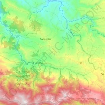
Name: Limoncito topographic map, elevation, terrain.
Location: Limoncito, Coto Brus, Puntarenas, 60804, Costa Rica (8.77451 -83.10670 8.92852 -82.98707)
Average elevation: 2,851 ft
Minimum elevation: 1,109 ft
Maximum elevation: 5,381 ft
Thank you for supporting this site ❤️
Make a donation
Make a donation
Gear up for your next adventure:
As an Amazon Associate, this site earns from qualifying purchases at no extra cost to you.