
Thank you for supporting this site ❤️
Make a donation
Make a donation
Gear up for your next adventure:
As an Amazon Associate, this site earns from qualifying purchases at no extra cost to you.
Summit topographic map
Click on the map to display elevation.
Thank you for supporting this site ❤️
Make a donation
Make a donation
Gear up for your next adventure:
As an Amazon Associate, this site earns from qualifying purchases at no extra cost to you.
About this map
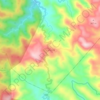
Name: Summit topographic map, elevation, terrain.
Location: Summit, Viga, Catanduanes, Bicol Region, Philippines (13.77053 124.24968 13.81053 124.28968)
Average elevation: 666 ft
Minimum elevation: 138 ft
Maximum elevation: 1,230 ft
Thank you for supporting this site ❤️
Make a donation
Make a donation
Gear up for your next adventure:
As an Amazon Associate, this site earns from qualifying purchases at no extra cost to you.