Geolocate

Sector 45 topographic map

Click on the map to display elevation.

About this map

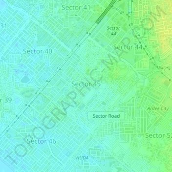
Name: Sector 45 topographic map, elevation, terrain.

Location: Sector 45, Gurgaon, Haryana, India (28.43688 77.05820 28.45247 77.07590)

Average elevation: 768 ft

Minimum elevation: 748 ft

Maximum elevation: 804 ft

Other topographic maps

Click on a map to view its topography, its elevation and its terrain.

Badshahpur

India > Haryana > Gurgaon

Average elevation: 748 ft

Damdama Lake

India > Haryana > Gurgaon

Average elevation: 794 ft

Gear up for your next adventure:

🕶️GPS Smartphone Mount - Secure mount for phone navigation
🗻Climbing Gear Basics - Essential gear for beginner climbers
🧼Biodegradable Camping Soap - Eco‑friendly soap for outdoor hygiene
🌧️Backpack Rain Cover - Keep gear dry in wet weather
🪶LED Camping Lantern - Bright lantern for camp lighting

As an Amazon Associate, this site earns from qualifying purchases at no extra cost to you.