
Thank you for supporting this site ❤️
Make a donation
Make a donation
Gear up for your next adventure:
As an Amazon Associate, this site earns from qualifying purchases at no extra cost to you.
Chapella topographic map
Click on the map to display elevation.
Thank you for supporting this site ❤️
Make a donation
Make a donation
Gear up for your next adventure:
As an Amazon Associate, this site earns from qualifying purchases at no extra cost to you.
About this map
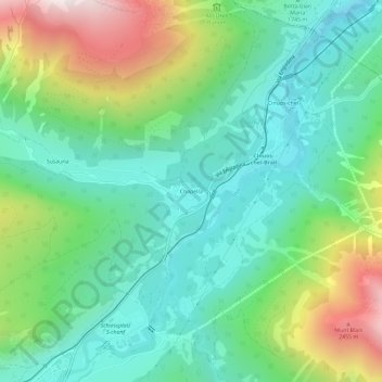
Name: Chapella topographic map, elevation, terrain.
Location: Chapella, S-chanf, Maloja, Grisons, 7526, Suisse (46.61331 9.99066 46.65331 10.03066)
Average elevation: 6,158 ft
Minimum elevation: 5,075 ft
Maximum elevation: 8,645 ft
Thank you for supporting this site ❤️
Make a donation
Make a donation
Gear up for your next adventure:
As an Amazon Associate, this site earns from qualifying purchases at no extra cost to you.