
Make a donation
Gear up for your next adventure:
As an Amazon Associate, this site earns from qualifying purchases at no extra cost to you.
Taney topographic map
Click on the map to display elevation.
Make a donation
Gear up for your next adventure:
As an Amazon Associate, this site earns from qualifying purchases at no extra cost to you.
Taney
Taney est un hameau d'alpage de Suisse situé dans le canton du Valais, dans le massif du Chablais, au-dessus de Miex, sur la commune de Vouvry. Il se trouve sous le Grammont et les Cornettes de Bise, au bord du lac de Taney, à 1 415 mètres d'altitude.
Make a donation
Gear up for your next adventure:
As an Amazon Associate, this site earns from qualifying purchases at no extra cost to you.
About this map
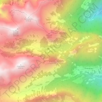
Name: Taney topographic map, elevation, terrain.
Location: Taney, Vouvry, Monthey, Valais, 1896, Suisse (46.32420 6.81408 46.36420 6.85408)
Average elevation: 4,974 ft
Minimum elevation: 1,988 ft
Maximum elevation: 7,142 ft
Make a donation
Gear up for your next adventure:
As an Amazon Associate, this site earns from qualifying purchases at no extra cost to you.