
Thank you for supporting this site ❤️
Make a donation
Make a donation
Gear up for your next adventure:
As an Amazon Associate, this site earns from qualifying purchases at no extra cost to you.
Malimatoc I topographic map
Click on the map to display elevation.
Thank you for supporting this site ❤️
Make a donation
Make a donation
Gear up for your next adventure:
As an Amazon Associate, this site earns from qualifying purchases at no extra cost to you.
About this map
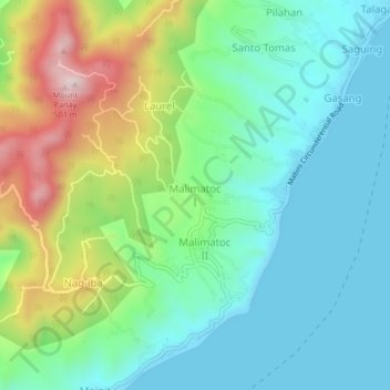
Name: Malimatoc I topographic map, elevation, terrain.
Location: Malimatoc I, Mabini, Batangas, Calabarzon, 4202, Philippines (13.69174 120.89183 13.73174 120.93183)
Average elevation: 472 ft
Minimum elevation: 0 ft
Maximum elevation: 1,621 ft
Thank you for supporting this site ❤️
Make a donation
Make a donation
Gear up for your next adventure:
As an Amazon Associate, this site earns from qualifying purchases at no extra cost to you.