
Bluffton topographic map
Click on the map to display elevation.
About this map
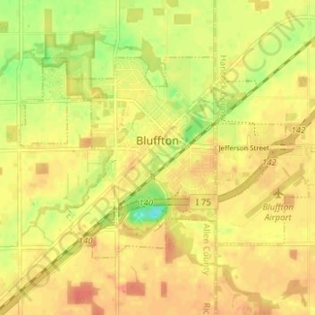
Name: Bluffton topographic map, elevation, terrain.
Location: Bluffton, Allen County, Ohio, 45817, United States (40.87595 -83.91917 40.90589 -83.85708)
Average elevation: 837 ft
Minimum elevation: 745 ft
Maximum elevation: 883 ft
Allen County trails, hiking, mountain biking, running and outdoor activities