Geolocate

Rome topographic map

Click on the map to display elevation.

About this map

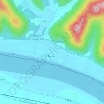
Name: Rome topographic map, elevation, terrain.

Location: Rome, Adams County, Ohio, United States (38.66117 -83.38490 38.66885 -83.37148)

Average elevation: 610 ft

Minimum elevation: 495 ft

Maximum elevation: 1,171 ft

Adams County trails, hiking, mountain biking, running and outdoor activities

Other topographic maps

Click on a map to view its topography, its elevation and its terrain.

Louden

United States > Ohio > Adams County

Average elevation: 794 ft

Ohio Brush Creek

United States > Ohio > Adams County

Average elevation: 892 ft

Tranquility

United States > Ohio > Adams County

Average elevation: 837 ft

Gear up for your next adventure:

🔭Stargazing Telescopes - Perfect for camping in low-light pollution areas shown on maps
🩹Survival Bandages - High‑quality bandages for emergencies
🪶Compact Camp Shovel - Folding shovel for campsite tasks
Backpacking Tent - Lightweight and durable tent for multi‑day hikes
🪓Survival Multi‑Tool - Versatile tool for camp and trail tasks

As an Amazon Associate, this site earns from qualifying purchases at no extra cost to you.