
Thank you for supporting this site ❤️
Make a donation
Make a donation
Gear up for your next adventure:
As an Amazon Associate, this site earns from qualifying purchases at no extra cost to you.
Açude Público Santa Cruz-RN topographic map
Click on the map to display elevation.
Thank you for supporting this site ❤️
Make a donation
Make a donation
Gear up for your next adventure:
As an Amazon Associate, this site earns from qualifying purchases at no extra cost to you.
About this map
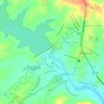
Name: Açude Público Santa Cruz-RN topographic map, elevation, terrain.
Average elevation: 778 ft
Minimum elevation: 712 ft
Maximum elevation: 886 ft
Thank you for supporting this site ❤️
Make a donation
Make a donation
Gear up for your next adventure:
As an Amazon Associate, this site earns from qualifying purchases at no extra cost to you.
Other topographic maps
Click on a map to view its topography, its elevation and its terrain.
Mirante Estátua Santa Rita de Cássia
Brasil > Rio Grande do Norte > Santa Cruz
Average elevation: 771 ft