Geolocate

Cornelius topographic map

Click on the map to display elevation.

About this map

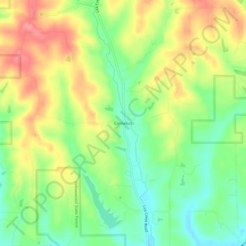
Name: Cornelius topographic map, elevation, terrain.

Location: Cornelius, Brown County, Indiana, 47435, United States (39.27932 -86.31825 39.31932 -86.27825)

Average elevation: 794 ft

Minimum elevation: 659 ft

Maximum elevation: 945 ft

Brown County trails, hiking, mountain biking, running and outdoor activities

Gear up for your next adventure:

📚Navigation Handbooks - Master the art of reading topographic maps and using a compass
🗺️NatGeo Topo Maps - High-quality waterproof printed topographic maps of US Parks
🧭Compass with Lanyard - Easy‑carry compass for navigation
🦶Carbon Trekking Poles - Reduce knee impact on steep descents with ultra-light poles
🧭Orienteering Set - Complete compass and map reading kit

As an Amazon Associate, this site earns from qualifying purchases at no extra cost to you.