Geolocate

Avoca topographic map

Click on the map to display elevation.

About this map

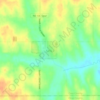
Name: Avoca topographic map, elevation, terrain.

Location: Avoca, Cass County, Nebraska, United States (40.79404 -96.12398 40.79861 -96.11506)

Average elevation: 1,204 ft

Minimum elevation: 1,142 ft

Maximum elevation: 1,263 ft

Cass County trails, hiking, mountain biking, running and outdoor activities

Gear up for your next adventure:

📌Outdoor GPS Map App - Apps and devices for digital topographic navigation
📦Dry Bags Set - Waterproof storage for electronics and clothes
🩹Survival Bandages - High‑quality bandages for emergencies
📦Gear Storage Bags - Organize and protect outdoor equipment
🪑Ultralight Camp Chairs - Portable seating for resting after a long day of mapping

As an Amazon Associate, this site earns from qualifying purchases at no extra cost to you.