Geolocate

Sarmar topographic map

Click on the map to display elevation.

About this map

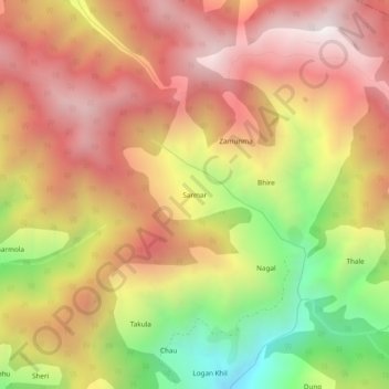
Name: Sarmar topographic map, elevation, terrain.

Location: Sarmar, Ramban, Ramban District, Jammu and Kashmir, India (33.25642 75.28056 33.29642 75.32056)

Average elevation: 7,671 ft

Minimum elevation: 5,059 ft

Maximum elevation: 9,587 ft

Gear up for your next adventure:

🔌Solar Panel Charger - Charge gear sustainably outdoors
🪑Ultralight Camp Chairs - Portable seating for resting after a long day of mapping
🎒Trekking Poles - Sturdy poles for balance and stability on rough terrain
🔭Compact Binoculars - HD vision for scouting terrain and identifying distant landmarks
🗻Climbing Gear Basics - Essential gear for beginner climbers

As an Amazon Associate, this site earns from qualifying purchases at no extra cost to you.