Geolocate

Rijkhoven topographic map

Click on the map to display elevation.

About this map

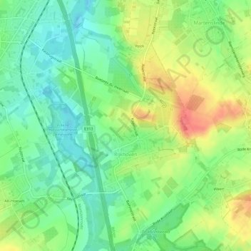
Name: Rijkhoven topographic map, elevation, terrain.

Location: Rijkhoven, Bilzen, Tongeren, Limburg, Belgium (50.82079 5.50379 50.85556 5.53416)

Average elevation: 256 ft

Minimum elevation: 174 ft

Maximum elevation: 374 ft

Gear up for your next adventure:

🪑Portable Camp Table - Compact table for campsite meals
😴Insulated Sleeping Pads - Compact and warm pads for high-elevation camping
🧭Orienteering Set - Complete compass and map reading kit
🚪Portable Camp Chair - Foldable chair for comfort at camp
📦Dry Bags Set - Waterproof storage for electronics and clothes

As an Amazon Associate, this site earns from qualifying purchases at no extra cost to you.