
华坛山镇 topographic map
Interactive map
Click on the map to display elevation.
About this map
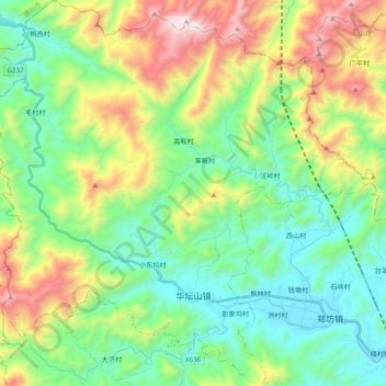
Name: 华坛山镇 topographic map, elevation, terrain.
Location: 华坛山镇, 广信区, 上饶市, 江西省, 中国 (28.67025 117.71164 28.84052 117.90632)
Average elevation: 1,749 ft
Minimum elevation: 384 ft
Maximum elevation: 4,738 ft
Other topographic maps
Click on a map to view its topography, its elevation and its terrain.