
Thank you for supporting this site ❤️
Make a donation
Make a donation
Gear up for your next adventure:
As an Amazon Associate, this site earns from qualifying purchases at no extra cost to you.
Masras topographic map
Click on the map to display elevation.
Thank you for supporting this site ❤️
Make a donation
Make a donation
Gear up for your next adventure:
As an Amazon Associate, this site earns from qualifying purchases at no extra cost to you.
About this map
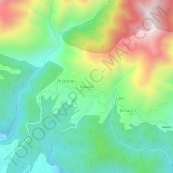
Name: Masras topographic map, elevation, terrain.
Location: Masras, Vikasnagar, Dehradun District, Uttarakhand, India (30.41625 77.96096 30.45625 78.00096)
Average elevation: 3,727 ft
Minimum elevation: 2,484 ft
Maximum elevation: 6,060 ft
Thank you for supporting this site ❤️
Make a donation
Make a donation
Gear up for your next adventure:
As an Amazon Associate, this site earns from qualifying purchases at no extra cost to you.