
Thank you for supporting this site ❤️
Make a donation
Make a donation
Gear up for your next adventure:
As an Amazon Associate, this site earns from qualifying purchases at no extra cost to you.
Tlaxiaco topographic map
Click on the map to display elevation.
Thank you for supporting this site ❤️
Make a donation
Make a donation
Gear up for your next adventure:
As an Amazon Associate, this site earns from qualifying purchases at no extra cost to you.
About this map
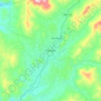
Name: Tlaxiaco topographic map, elevation, terrain.
Location: Tlaxiaco, Oaxaca, 69800, Mexico (17.22944 -97.71917 17.30944 -97.63917)
Average elevation: 7,064 ft
Minimum elevation: 6,437 ft
Maximum elevation: 8,593 ft
Thank you for supporting this site ❤️
Make a donation
Make a donation
Gear up for your next adventure:
As an Amazon Associate, this site earns from qualifying purchases at no extra cost to you.