Geolocate

Crocker topographic map

Click on the map to display elevation.

About this map

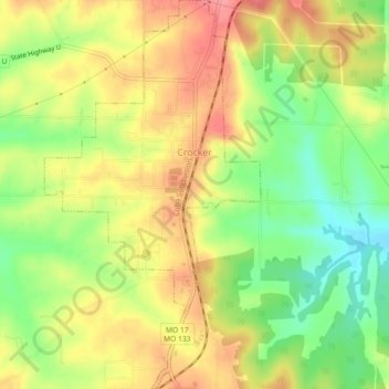
Name: Crocker topographic map, elevation, terrain.

Location: Crocker, Pulaski County, Missouri, United States (37.92714 -92.28128 37.96287 -92.25607)

Average elevation: 1,040 ft

Minimum elevation: 883 ft

Maximum elevation: 1,184 ft

Pulaski County trails, hiking, mountain biking, running and outdoor activities

Other topographic maps

Click on a map to view its topography, its elevation and its terrain.

Devils Elbow

United States > Missouri > Pulaski County

Average elevation: 846 ft

Gear up for your next adventure:

🛡️Insect Repellent - Protection against bugs during outdoor activities
📌Outdoor GPS Map App - Apps and devices for digital topographic navigation
🧥Waterproof Jacket for Hiking - Breathable and rugged rain jacket for outdoor excursions
📡GPS Antenna Upgrade - Enhance GPS reception in remote terrain
🥾Hiking Shoes - Durable and comfortable shoes for trail hiking

As an Amazon Associate, this site earns from qualifying purchases at no extra cost to you.