Geolocate

Bagneri topographic map

Click on the map to display elevation.

About this map

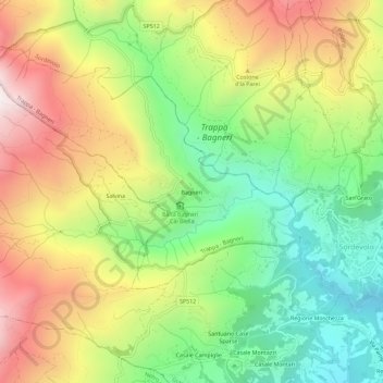
Name: Bagneri topographic map, elevation, terrain.

Location: Bagneri, Muzzano, Biella, Piemonte, 13817, Italia (45.55933 7.92965 45.59933 7.96965)

Average elevation: 3,314 ft

Minimum elevation: 1,670 ft

Maximum elevation: 5,390 ft

Gear up for your next adventure:

🔭Stargazing Telescopes - Perfect for camping in low-light pollution areas shown on maps
🧭Orienteering Set - Complete compass and map reading kit
🎒Gear Packing Cubes - Organize your backpack efficiently
🌎3D Topographic Globes - Raised relief globes for a tactile understanding of geography
🥇GPS Hiking Watch - Multi‑sport GPS watch with navigation and trail tracking

As an Amazon Associate, this site earns from qualifying purchases at no extra cost to you.