Geolocate

Mlati topographic map

Click on the map to display elevation.

About this map
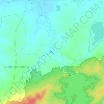
Name: Mlati topographic map, elevation, terrain.

Location: Mlati, Lamongan, East Java, Java, Indonesia (-7.22707 112.18242 -7.18707 112.22242)

Average elevation: 138 ft

Minimum elevation: 79 ft

Maximum elevation: 292 ft

Other topographic maps

Click on a map to view its topography, its elevation and its terrain.

Sukorame

Indonesia > East Java > Lamongan

Average elevation: 331 ft

Bluluk

Indonesia > East Java > Lamongan

Average elevation: 240 ft

Sambeng

Indonesia > East Java > Lamongan

Average elevation: 259 ft

Jejel

Indonesia > East Java > Lamongan > Ngimbang

Average elevation: 262 ft

Ngimbang

Indonesia > East Java > Lamongan

Average elevation: 292 ft

Garung

Indonesia > East Java > Lamongan > Sambeng

Average elevation: 249 ft

Wonorejo

Indonesia > East Java > Lamongan > Sambeng

Average elevation: 266 ft

Pataan

Indonesia > East Java > Lamongan > Sambeng

Average elevation: 335 ft

Pamotan

Indonesia > East Java > Lamongan > Sambeng

Average elevation: 256 ft

Selorejo

Indonesia > East Java > Lamongan > Sambeng

Average elevation: 180 ft

Gear up for your next adventure:

⛺Backpacking Tents - Weight-optimized shelters for multi-day topographic surveys
🪶LED Camping Lantern - Bright lantern for camp lighting
🦶Carbon Trekking Poles - Reduce knee impact on steep descents with ultra-light poles
🛏️Cold Weather Sleeping Bag - Warm sleeping bag for cold conditions
⌚Solar GPS Watches - Advanced multisport watches with built-in topographic maps

As an Amazon Associate, this site earns from qualifying purchases at no extra cost to you.