Geolocate

Panayakan topographic map

Click on the map to display elevation.

About this map

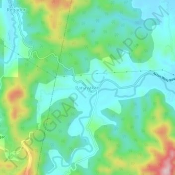
Name: Panayakan topographic map, elevation, terrain.

Location: Panayakan, Tangalan, Aklan, Western Visayas, Philippines (11.74213 122.19940 11.78213 122.23940)

Average elevation: 259 ft

Minimum elevation: 13 ft

Maximum elevation: 922 ft

Gear up for your next adventure:

🛠️Outdoor Gear Repair Kit - Essential tools to fix gear on the trail
🧼Biodegradable Camping Soap - Eco‑friendly soap for outdoor hygiene
🕶️Glacier Sunglasses - Side shields to protect eyes from high-altitude snow glare
Backpacking Tent - Lightweight and durable tent for multi‑day hikes
🧤Hiking Gloves - Protective gloves for rugged trails

As an Amazon Associate, this site earns from qualifying purchases at no extra cost to you.