
Thank you for supporting this site ❤️
Make a donation
Make a donation
Gear up for your next adventure:
As an Amazon Associate, this site earns from qualifying purchases at no extra cost to you.
Freamunde topographic map
Click on the map to display elevation.
Thank you for supporting this site ❤️
Make a donation
Make a donation
Gear up for your next adventure:
As an Amazon Associate, this site earns from qualifying purchases at no extra cost to you.
About this map
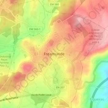
Name: Freamunde topographic map, elevation, terrain.
Location: Freamunde, Paços de Ferreira, Oporto, Portugal (41.27495 -8.35659 41.30208 -8.32309)
Average elevation: 1,125 ft
Minimum elevation: 830 ft
Maximum elevation: 1,319 ft
Thank you for supporting this site ❤️
Make a donation
Make a donation
Gear up for your next adventure:
As an Amazon Associate, this site earns from qualifying purchases at no extra cost to you.