Geolocate

Kainchi topographic map

Click on the map to display elevation.

About this map

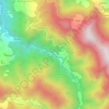
Name: Kainchi topographic map, elevation, terrain.

Location: Kainchi, Kosya Kutauli, Nainital District, Uttarakhand, India (29.41116 79.48529 29.45116 79.52529)

Average elevation: 5,495 ft

Minimum elevation: 3,530 ft

Maximum elevation: 7,415 ft

Gear up for your next adventure:

🧭Outdoor Navigation Book - Learn advanced navigation skills
Camping Coffee Makers - Enjoy premium coffee at the summit or campsite
🛠️Outdoor Gear Repair Kit - Essential tools to fix gear on the trail
🪶Fire Starter Kit - Reliable fire starter for survival and camping
🧭Map Reading Tools - Tools and kits for map navigation

As an Amazon Associate, this site earns from qualifying purchases at no extra cost to you.