
Thank you for supporting this site ❤️
Make a donation
Make a donation
Gear up for your next adventure:
As an Amazon Associate, this site earns from qualifying purchases at no extra cost to you.
Ciputri topographic map
Click on the map to display elevation.
Thank you for supporting this site ❤️
Make a donation
Make a donation
Gear up for your next adventure:
As an Amazon Associate, this site earns from qualifying purchases at no extra cost to you.
About this map
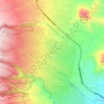
Name: Ciputri topographic map, elevation, terrain.
Location: Ciputri, Cianjur, West-Java, Jawa, Indonesien (-6.79472 107.03245 -6.75472 107.07245)
Average elevation: 3,520 ft
Minimum elevation: 2,641 ft
Maximum elevation: 4,344 ft
Thank you for supporting this site ❤️
Make a donation
Make a donation
Gear up for your next adventure:
As an Amazon Associate, this site earns from qualifying purchases at no extra cost to you.