
Make a donation
Gear up for your next adventure:
As an Amazon Associate, this site earns from qualifying purchases at no extra cost to you.
Kritsa topographic map
Click on the map to display elevation.
Make a donation
Gear up for your next adventure:
As an Amazon Associate, this site earns from qualifying purchases at no extra cost to you.
Kritsa
Kritsa (Greek: Κριτσά, romanized: Critsá) is one of the oldest and most picturesque villages in Crete, Greece, built amphitheatrically on a rock hill, named Kastellos, surrounded by olive groves, at an altitude of 375 m. It is part of the municipality of Agios Nikolaos. During the Middle Ages, it was thought to be the largest village in Crete. Kritsa has been destroyed many times during the last centuries because it participated in all of Crete's revolutions. It is located 10 km from Agios Nikolaos and has about 2200 inhabitants who live in different neighborhoods named Palemilos, Koukistres, Christos and Pergiolikia.
Make a donation
Gear up for your next adventure:
As an Amazon Associate, this site earns from qualifying purchases at no extra cost to you.
About this map
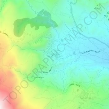
Name: Kritsa topographic map, elevation, terrain.
Average elevation: 1,463 ft
Minimum elevation: 600 ft
Maximum elevation: 3,520 ft
Make a donation
Gear up for your next adventure:
As an Amazon Associate, this site earns from qualifying purchases at no extra cost to you.