
Make a donation
Gear up for your next adventure:
As an Amazon Associate, this site earns from qualifying purchases at no extra cost to you.
Grote-Spouwen topographic map
Click on the map to display elevation.
Make a donation
Gear up for your next adventure:
As an Amazon Associate, this site earns from qualifying purchases at no extra cost to you.
Grote-Spouwen
Grote-Spouwen ligt in droog-Haspengouw, op een hoogte van 72 tot 112 meter. Het is een open landschap, vooral in gebruik door de landbouw en de fruitteelt. Bij Weert vindt men nog het Weerterbosje, een oud hellingbos.
Make a donation
Gear up for your next adventure:
As an Amazon Associate, this site earns from qualifying purchases at no extra cost to you.
About this map
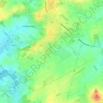
Name: Grote-Spouwen topographic map, elevation, terrain.
Location: Grote-Spouwen, Bilzen, Tongeren, Limburg, België (50.81635 5.52283 50.83885 5.56985)
Average elevation: 315 ft
Minimum elevation: 246 ft
Maximum elevation: 413 ft
Make a donation
Gear up for your next adventure:
As an Amazon Associate, this site earns from qualifying purchases at no extra cost to you.