Geolocate

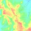
Madisonville topographic map

Click on the map to display elevation.

About this map

Name: Madisonville topographic map, elevation, terrain.

Location: Madisonville, Hopkins County, Kentucky, 42431, United States (37.28413 -87.55496 37.39699 -87.45218)

Average elevation: 446 ft

Minimum elevation: 361 ft

Maximum elevation: 617 ft

Hopkins County trails, hiking, mountain biking, running and outdoor activities

Other topographic maps

Click on a map to view its topography, its elevation and its terrain.

Fies

United States > Kentucky > Hopkins County

Average elevation: 400 ft

Rabbit Ridge

United States > Kentucky > Hopkins County

Average elevation: 449 ft

Gear up for your next adventure:

🥘Titanium Cookware - Durable, featherlight pots and pans for backpacking
🧭Outdoor Navigation Book - Learn advanced navigation skills
🪵Folding Camp Saw - Compact saw for wood and campsite work
🧼Biodegradable Camping Soap - Eco‑friendly soap for outdoor hygiene
👟Trail Running Shoes - Lightweight shoes for trail runners

As an Amazon Associate, this site earns from qualifying purchases at no extra cost to you.