

Ballan topographic map
Click on the map to display elevation.
Ballan
Ballan has a oceanic climate (Köppen: Cfb), with very mild, relatively dry summers and cool, slightly wetter winters. Influenced by its elevation (442 m (1,450 ft)); average maxima vary from 24.6 °C (76.3 °F) in January to 10.2 °C (50.4 °F) in July, while average minima fluctuate between 10.3 °C (50.5 °F) in February and 2.8 °C (37.0 °F) in July. Mean average annual precipitation is moderately low: 571.2 mm (22.49 in), and is spread between 138.5 precipitation days. Despite this, the town is not very sunny, with 165.2 cloudy days and only 58.0 clear days per annum. Extreme temperatures have ranged from 43.2 °C (109.8 °F) on 31 January 1968 to −5.8 °C (21.6 °F) on 16 August 1967.
About this map
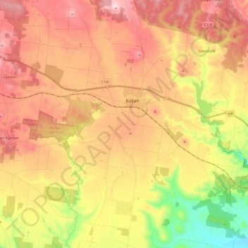
Name: Ballan topographic map, elevation, terrain.
Location: Ballan, Shire of Moorabool, Victoria, 3342, Australia (-37.66968 144.13013 -37.53797 144.30939)
Average elevation: 1,627 ft
Minimum elevation: 863 ft
Maximum elevation: 2,192 ft