
Make a donation
Gear up for your next adventure:
As an Amazon Associate, this site earns from qualifying purchases at no extra cost to you.
Veurne topographic map
Click on the map to display elevation.
Make a donation
Gear up for your next adventure:
As an Amazon Associate, this site earns from qualifying purchases at no extra cost to you.
Veurne
Elk jaar organiseert de Sodaliteit van de Gekruisigde Zaligmaker een jaarlijkse openbare Boetprocessie. De processie bestaat uit groepen die op een volkse manier zowel het Oude als het Nieuwe Testament uitbeelden met als hoogtepunt het lijden en de dood van Jezus Christus. Vele penitenten en bedevaarders nemen deel aan deze processie. Ze trekt jaarlijks de laatste zondag van juli door de stad en valt samen met Veurne-Kermis, de jaarlijkse foor.
Make a donation
Gear up for your next adventure:
As an Amazon Associate, this site earns from qualifying purchases at no extra cost to you.
About this map
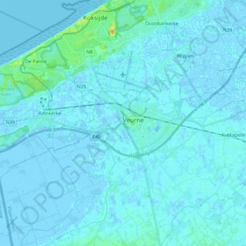
Name: Veurne topographic map, elevation, terrain.
Location: Veurne, West-Vlaanderen, Vlaanderen, België (51.05162 2.60082 51.09029 2.77687)
Average elevation: 7 ft
Minimum elevation: -13 ft
Maximum elevation: 89 ft
Make a donation
Gear up for your next adventure:
As an Amazon Associate, this site earns from qualifying purchases at no extra cost to you.
Other topographic maps
Click on a map to view its topography, its elevation and its terrain.
Westhoekduinen, duinen van Cabour, De Moeren en plateau van Izenberge
België > West-Vlaanderen > Veurne > Veurne
Average elevation: 3 ft
Make a donation
Gear up for your next adventure:
As an Amazon Associate, this site earns from qualifying purchases at no extra cost to you.