
Thank you for supporting this site ❤️
Make a donation
Make a donation
Gear up for your next adventure:
As an Amazon Associate, this site earns from qualifying purchases at no extra cost to you.
Challenge topographic map
Click on the map to display elevation.
Thank you for supporting this site ❤️
Make a donation
Make a donation
Gear up for your next adventure:
As an Amazon Associate, this site earns from qualifying purchases at no extra cost to you.
About this map
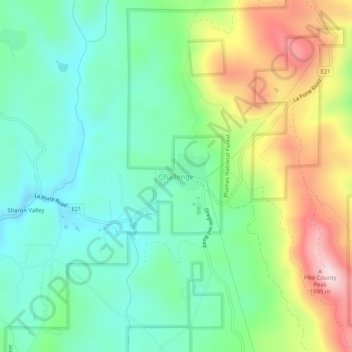
Name: Challenge topographic map, elevation, terrain.
Location: Challenge, Yuba County, California, 95925, United States (39.46590 -121.24475 39.50590 -121.20475)
Average elevation: 2,746 ft
Minimum elevation: 2,280 ft
Maximum elevation: 3,668 ft
Thank you for supporting this site ❤️
Make a donation
Make a donation
Gear up for your next adventure:
As an Amazon Associate, this site earns from qualifying purchases at no extra cost to you.