
Thank you for supporting this site ❤️
Make a donation
Make a donation
Gear up for your next adventure:
As an Amazon Associate, this site earns from qualifying purchases at no extra cost to you.
Lotus Districts topographic map
Click on the map to display elevation.
Thank you for supporting this site ❤️
Make a donation
Make a donation
Gear up for your next adventure:
As an Amazon Associate, this site earns from qualifying purchases at no extra cost to you.
About this map
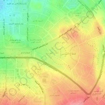
Name: Lotus Districts topographic map, elevation, terrain.
Location: Lotus Districts, New Cairo City, Cairo, 11865, Egypt (30.00725 31.48656 30.04725 31.52656)
Average elevation: 1,030 ft
Minimum elevation: 860 ft
Maximum elevation: 1,171 ft
Thank you for supporting this site ❤️
Make a donation
Make a donation
Gear up for your next adventure:
As an Amazon Associate, this site earns from qualifying purchases at no extra cost to you.