
Thank you for supporting this site ❤️
Make a donation
Make a donation
Gear up for your next adventure:
As an Amazon Associate, this site earns from qualifying purchases at no extra cost to you.
Strullendorf topographic map
Click on the map to display elevation.
Thank you for supporting this site ❤️
Make a donation
Make a donation
Gear up for your next adventure:
As an Amazon Associate, this site earns from qualifying purchases at no extra cost to you.
About this map
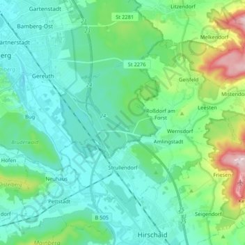
Name: Strullendorf topographic map, elevation, terrain.
Location: Strullendorf, Landkreis Bamberg, Bayern, 96129, Deutschland (49.82843 10.92845 49.89731 11.08958)
Average elevation: 974 ft
Minimum elevation: 751 ft
Maximum elevation: 1,837 ft
Thank you for supporting this site ❤️
Make a donation
Make a donation
Gear up for your next adventure:
As an Amazon Associate, this site earns from qualifying purchases at no extra cost to you.