Geolocate

Fossgrenda topographic map

Click on the map to display elevation.

About this map

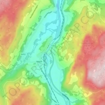
Name: Fossgrenda topographic map, elevation, terrain.

Location: Fossgrenda, Hovin, Melhus, Trøndelag, 7236, Norway (63.08899 10.21538 63.12899 10.25538)

Average elevation: 594 ft

Minimum elevation: 52 ft

Maximum elevation: 1,329 ft

Gear up for your next adventure:

❄️Traction Cleats - Prevent slips on icy trails during winter hikes
🎒Day Hiking Backpack - Lightweight backpack perfect for day trips and outdoor adventures
🧣Merino Neck Gaiters - Multi-functional headwear for wind and sun protection
📚USA Hiking Guide Books - Top trail guides and map books
Backpacking Tents - Weight-optimized shelters for multi-day topographic surveys

As an Amazon Associate, this site earns from qualifying purchases at no extra cost to you.