
Thank you for supporting this site ❤️
Make a donation
Make a donation
Gear up for your next adventure:
As an Amazon Associate, this site earns from qualifying purchases at no extra cost to you.
Biesmerée topographic map
Click on the map to display elevation.
Thank you for supporting this site ❤️
Make a donation
Make a donation
Gear up for your next adventure:
As an Amazon Associate, this site earns from qualifying purchases at no extra cost to you.
About this map
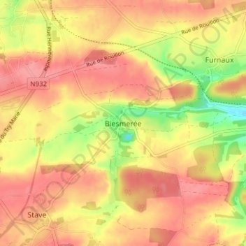
Name: Biesmerée topographic map, elevation, terrain.
Location: Biesmerée, Mettet, Namen, Wallonië, 5640, België (50.27766 4.66098 50.31766 4.70098)
Average elevation: 830 ft
Minimum elevation: 659 ft
Maximum elevation: 919 ft
Thank you for supporting this site ❤️
Make a donation
Make a donation
Gear up for your next adventure:
As an Amazon Associate, this site earns from qualifying purchases at no extra cost to you.