
Thank you for supporting this site ❤️
Make a donation
Make a donation
Gear up for your next adventure:
As an Amazon Associate, this site earns from qualifying purchases at no extra cost to you.
Giétroz topographic map
Click on the map to display elevation.
Thank you for supporting this site ❤️
Make a donation
Make a donation
Gear up for your next adventure:
As an Amazon Associate, this site earns from qualifying purchases at no extra cost to you.
About this map
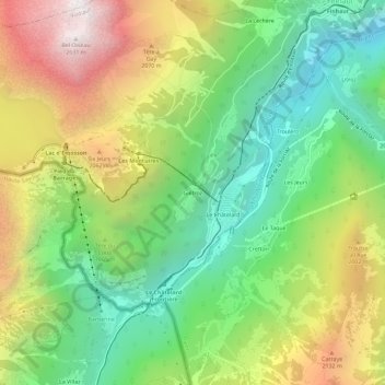
Name: Giétroz topographic map, elevation, terrain.
Location: Giétroz, Finhaut, Saint-Maurice, Wallis, 1925, Switzerland (46.04285 6.93445 46.08285 6.97445)
Average elevation: 5,266 ft
Minimum elevation: 2,992 ft
Maximum elevation: 8,615 ft
Thank you for supporting this site ❤️
Make a donation
Make a donation
Gear up for your next adventure:
As an Amazon Associate, this site earns from qualifying purchases at no extra cost to you.