Geolocate

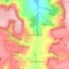
Hawling topographic map

Click on the map to display elevation.

About this map
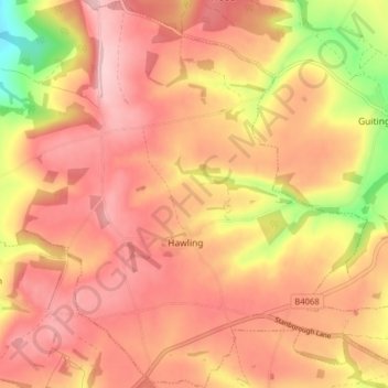
Name: Hawling topographic map, elevation, terrain.

Location: Hawling, Tewkesbury, Gloucestershire, England, United Kingdom (51.88700 -1.92993 51.93578 -1.85362)

Average elevation: 791 ft

Minimum elevation: 400 ft

Maximum elevation: 984 ft

Other topographic maps

Click on a map to view its topography, its elevation and its terrain.

Leigh

United Kingdom > England > Gloucestershire > Tewkesbury

Average elevation: 56 ft

Cleeve Hill

United Kingdom > England > Gloucestershire > Tewkesbury

Average elevation: 892 ft

Alderton

United Kingdom > England > Gloucestershire > Tewkesbury

Average elevation: 223 ft

Wormington

United Kingdom > England > Gloucestershire > Tewkesbury

Average elevation: 184 ft

Didbrook

United Kingdom > England > Gloucestershire > Tewkesbury

Average elevation: 404 ft

Witcombe

United Kingdom > England > Gloucestershire > Tewkesbury

Average elevation: 459 ft

Gear up for your next adventure:

🧦Hiking Socks - Comfortable socks to prevent blisters on long hikes
🪶Compact Camp Shovel - Folding shovel for campsite tasks
🚑Emergency Bivvies - Heat-reflective sleeping bags for survival situations
🖼️Topo Map Wall Art - Decorative topographic prints of famous peaks and regions
📚Navigation Handbooks - Master the art of reading topographic maps and using a compass

As an Amazon Associate, this site earns from qualifying purchases at no extra cost to you.