Geolocate

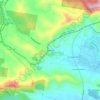
Boambee topographic map

Click on the map to display elevation.

About this map

Name: Boambee topographic map, elevation, terrain.

Location: Boambee, Coffs Harbour, New South Wales, Australia (-30.35127 153.02817 -30.31447 153.08923)

Average elevation: 59 ft

Minimum elevation: -3 ft

Maximum elevation: 610 ft

Other topographic maps

Click on a map to view its topography, its elevation and its terrain.
Red Hill

Australia > New South Wales > Coffs Harbour

Average elevation: 387 ft

Central Bucca

Australia > New South Wales > Coffs Harbour

Average elevation: 453 ft

Dunvegan

Australia > New South Wales > Coffs Harbour

Average elevation: 541 ft

Landrigans

Australia > New South Wales > Coffs Harbour

Average elevation: 515 ft

Gear up for your next adventure:

🗃️Trail First Aid Kit - Essential kit for outdoor injuries and emergencies
🧤Tactile Hiking Gloves - Keep hands warm while operating GPS and smartphone screens
🌧️Backpack Rain Cover - Keep gear dry in wet weather
🖼️Topo Map Wall Art - Decorative topographic prints of famous peaks and regions
🚪Portable Camp Chair - Foldable chair for comfort at camp

As an Amazon Associate, this site earns from qualifying purchases at no extra cost to you.