Geolocate

Campbell topographic map

Click on the map to display elevation.

About this map

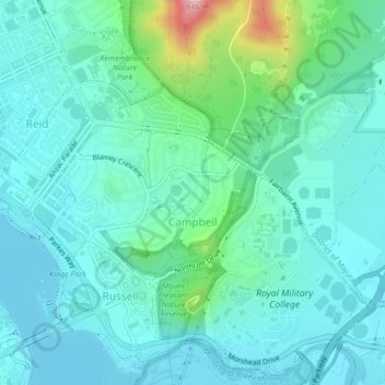
Name: Campbell topographic map, elevation, terrain.

Location: Campbell, Canberra, District of Canberra Central, Australian Capital Territory, 2612, Australia (-35.30579 149.14116 -35.27166 149.17751)

Average elevation: 1,955 ft

Minimum elevation: 1,818 ft

Maximum elevation: 2,569 ft

Other topographic maps

Click on a map to view its topography, its elevation and its terrain.

City Hill

Australia > Canberra

Average elevation: 1,870 ft

Mount Ainslie

Australia > Canberra

Mount Ainslie is a hill with an elevation of 843 metres (2,766 ft) AHD that is located in the northeastern suburbs of Canberra, in the Australian Capital Territory, Australia. Mount Ainslie lies within part of the Canberra Nature Park.

Average elevation: 2,129 ft

Gear up for your next adventure:

🥩Freeze-Dried Meals - Nutritious and lightweight food for remote expeditions
💧Water Purification System - Clean water on the trail with reliable purifiers
🏔️Mountain Trail Maps - High‑detail maps for popular peaks
🛰️Satellite Messengers - Emergency SOS and two-way messaging for off-grid adventures
🧺Microfiber Travel Towels - Compact and fast-drying towels for trail use

As an Amazon Associate, this site earns from qualifying purchases at no extra cost to you.