Geolocate

Rahata topographic map

Click on the map to display elevation.

About this map

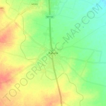
Name: Rahata topographic map, elevation, terrain.

Location: Rahata, Rahta, Ahmednagar District, Maharashtra, 423107, India (19.67706 74.43996 19.75706 74.51996)

Average elevation: 1,706 ft

Minimum elevation: 1,637 ft

Maximum elevation: 1,778 ft

Gear up for your next adventure:

🎒Trail Energy Bars - High‑calorie bars for hiking energy
🏫Relief Map Kits - Hands-on tools for teaching landforms and elevation
🧭Pro Hiking Compasses - High-accuracy liquid-filled compasses for topographic orientation
🧴Hand Sanitizer - Keep hands clean while hiking
🎒Day Hiking Backpack - Lightweight backpack perfect for day trips and outdoor adventures

As an Amazon Associate, this site earns from qualifying purchases at no extra cost to you.