Geolocate

Wanchese topographic map

Click on the map to display elevation.

About this map
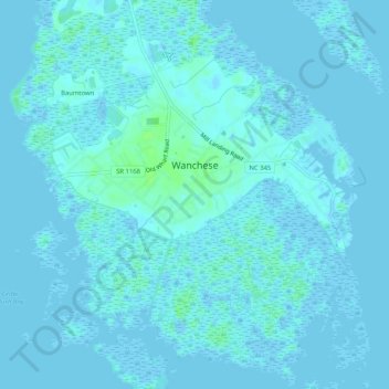
Name: Wanchese topographic map, elevation, terrain.

Location: Wanchese, Dare County, North Carolina, 27981, United States (35.81864 -75.66478 35.86034 -75.61477)

Average elevation: 3 ft

Minimum elevation: -16 ft

Maximum elevation: 26 ft

Dare County trails, hiking, mountain biking, running and outdoor activities

Gear up for your next adventure:

👟Trail Running Shoes - Lightweight shoes for trail runners
🗻Climbing Gear Basics - Essential gear for beginner climbers
🪶Wildlife Field Guides - Learn animal tracking and species ID
🦶Hiking Gaiters - Keep debris and water out of your boots
🥇GPS Hiking Watch - Multi‑sport GPS watch with navigation and trail tracking

As an Amazon Associate, this site earns from qualifying purchases at no extra cost to you.