
Pelly Crossing topographic map
Interactive map
Click on the map to display elevation.
About this map
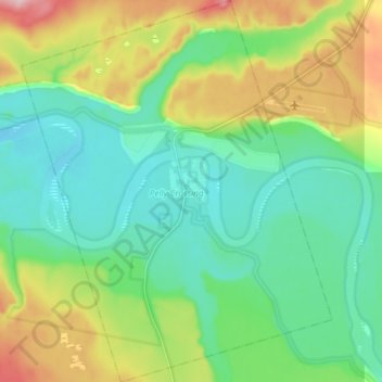
Name: Pelly Crossing topographic map, elevation, terrain.
Location: Pelly Crossing, Yukon, Y0B 1P0, Canada (62.78365 -136.64675 62.85821 -136.51376)
Average elevation: 1,680 ft
Minimum elevation: 1,493 ft
Maximum elevation: 2,123 ft