Geolocate

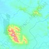
Lembang topographic map

Click on the map to display elevation.

About this map

Name: Lembang topographic map, elevation, terrain.

Location: Lembang, Sanggau Ledo, Bengkayang, West Kalimantan, Indonesia (1.12795 109.67933 1.16795 109.71933)

Average elevation: 138 ft

Minimum elevation: 36 ft

Maximum elevation: 361 ft

Other topographic maps

Click on a map to view its topography, its elevation and its terrain.
Siding

Indonesia > West Kalimantan > Bengkayang

Average elevation: 1,188 ft

Lumar

Indonesia > West Kalimantan > Bengkayang

Average elevation: 463 ft

Gear up for your next adventure:

🛡️Bear Spray Outdoor - Protection in bear country hikes
🎒Outdoor Daypacks - Lightweight backpacks designed for carrying maps and essential gear
📻Weather Alert Radios - Stay informed of storm risks while off-the-grid
🔦Compact Flashlight - Reliable flashlight for emergencies
🎒Day Hiking Backpack - Lightweight backpack perfect for day trips and outdoor adventures

As an Amazon Associate, this site earns from qualifying purchases at no extra cost to you.