Geolocate

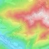
Escalette topographic map

Click on the map to display elevation.

About this map

Name: Escalette topographic map, elevation, terrain.

Location: Escalette, Boutx, Saint-Gaudens, Haute-Garonne, Occitanie, France métropolitaine, 31440, France (42.93437 0.72822 42.93447 0.72832)

Average elevation: 4,055 ft

Minimum elevation: 2,490 ft

Maximum elevation: 5,971 ft

Other topographic maps

Click on a map to view its topography, its elevation and its terrain.
Argut-Dessus

France > Occitanie > Haute-Garonne > Boutx

Average elevation: 3,743 ft

Couledoux

France > Occitanie > Haute-Garonne > Boutx

Average elevation: 3,671 ft

Gear up for your next adventure:

🪶Trail Camera - Capture wildlife on your hikes
📌Outdoor GPS Map App - Apps and devices for digital topographic navigation
🎒Hydration Pack - Hands‑free water reservoir for long hikes
🪶Compact Camp Shovel - Folding shovel for campsite tasks
🖼️Topo Map Wall Art - Decorative topographic prints of famous peaks and regions

As an Amazon Associate, this site earns from qualifying purchases at no extra cost to you.