
Thank you for supporting this site ❤️
Make a donation
Make a donation
Gear up for your next adventure:
As an Amazon Associate, this site earns from qualifying purchases at no extra cost to you.
Salvadonica topographic map
Click on the map to display elevation.
Thank you for supporting this site ❤️
Make a donation
Make a donation
Gear up for your next adventure:
As an Amazon Associate, this site earns from qualifying purchases at no extra cost to you.
About this map
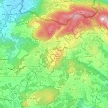
Name: Salvadonica topographic map, elevation, terrain.
Location: Salvadonica, Parè, Colverde, Como, Lombardia, 22041, Italia (45.78706 8.99115 45.82706 9.03115)
Average elevation: 1,293 ft
Minimum elevation: 846 ft
Maximum elevation: 1,903 ft
Thank you for supporting this site ❤️
Make a donation
Make a donation
Gear up for your next adventure:
As an Amazon Associate, this site earns from qualifying purchases at no extra cost to you.