Geolocate

Kanasín topographic map

Click on the map to display elevation.

About this map
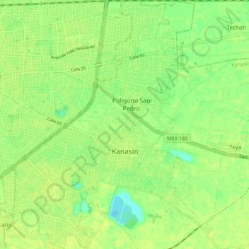
Name: Kanasín topographic map, elevation, terrain.

Location: Kanasín, Yucatán, 97370, Mexico (20.89613 -89.60336 20.98195 -89.52897)

Average elevation: 36 ft

Minimum elevation: 3 ft

Maximum elevation: 49 ft

Gear up for your next adventure:

🔭Telescopic Hiking Pole - Adjustable pole for hiking stability
☕Camping Coffee Makers - Enjoy premium coffee at the summit or campsite
🧦Hiking Socks - Comfortable socks to prevent blisters on long hikes
⛑️Personal Locator Beacon - Safety beacon for emergencies
📱Heavy-Duty Phone Cases - Drop-proof and waterproof protection for outdoor navigation

As an Amazon Associate, this site earns from qualifying purchases at no extra cost to you.