Geolocate

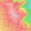
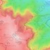
Cranley topographic map

Click on the map to display elevation.

About this map

Name: Cranley topographic map, elevation, terrain.

Location: Cranley, Toowoomba, Queensland, Australia (-27.53173 151.90646 -27.49306 151.94442)

Average elevation: 1,873 ft

Minimum elevation: 1,601 ft

Maximum elevation: 2,234 ft

Other topographic maps

Click on a map to view its topography, its elevation and its terrain.
West Creek Park

Australia > Queensland > Toowoomba

Average elevation: 2,139 ft

Mount Lofty

Australia > Queensland > Toowoomba

Average elevation: 2,014 ft

Toowoomba City

Australia > Queensland > Toowoomba

Average elevation: 2,018 ft

Picnic Point

Australia > Queensland > Toowoomba

The first addition to the Picnic Point Reserve was made when the Municipal Council purchased two freehold allotments fronting both Heller and Rowbotham Streets in 1902. By 1906 the council had commenced tree-planting at Picnic Point under the supervision of Curator Harding of the Botanical gardens. A further…

Average elevation: 1,886 ft
Ravensbourne

Australia > Queensland > Toowoomba

Average elevation: 1,913 ft

Glenvale

Australia > Queensland > Toowoomba

Average elevation: 1,854 ft

Cawdor

Australia > Queensland > Toowoomba

Average elevation: 1,883 ft

Captain Cook Reserve

Australia > Queensland > Toowoomba

Average elevation: 2,083 ft

Lookout

Australia > Queensland > Toowoomba

Average elevation: 1,798 ft

Gear up for your next adventure:

🛡️Insect Repellent - Protection against bugs during outdoor activities
🎒Waterproof Dry Bags - Keep your electronics and maps dry inside your pack
🗺️NatGeo Topo Maps - High-quality waterproof printed topographic maps of US Parks
🔥Fast-Boil Camping Stoves - Efficient cooking systems for quick trail meals
🧣Merino Neck Gaiters - Multi-functional headwear for wind and sun protection

As an Amazon Associate, this site earns from qualifying purchases at no extra cost to you.