Geolocate

Tarzan Falls topographic map

Click on the map to display elevation.

About this map

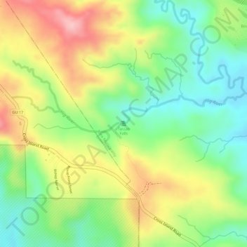
Name: Tarzan Falls topographic map, elevation, terrain.

Location: Tarzan Falls, Yona Municipality, Guam, 96915, United States (13.39605 144.72048 13.39615 144.72058)

Average elevation: 371 ft

Minimum elevation: 85 ft

Maximum elevation: 709 ft

Guam trails, hiking, mountain biking, running and outdoor activities

Gear up for your next adventure:

📚USA Hiking Guide Books - Top trail guides and map books
📡Handheld GPS Device - Reliable handheld GPS for outdoor navigation
🔭Compact Binoculars - HD vision for scouting terrain and identifying distant landmarks
🛡️Insect Repellent - Protection against bugs during outdoor activities
🧥Men's Rain Shells - Premium waterproof and breathable jackets for mountain weather

As an Amazon Associate, this site earns from qualifying purchases at no extra cost to you.