Geolocate

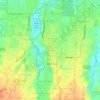
Tangkahan topographic map

Click on the map to display elevation.

About this map

Name: Tangkahan topographic map, elevation, terrain.

Location: Tangkahan, Kabupaten Deli Serdang, North Sumatra, 20356, Indonesia (3.40778 98.62351 3.44778 98.66351)

Average elevation: 361 ft

Minimum elevation: 203 ft

Maximum elevation: 581 ft

Other topographic maps

Click on a map to view its topography, its elevation and its terrain.

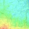
Sunggal

Indonesia > North Sumatra > Kabupaten Deli Serdang

Average elevation: 115 ft

Gear up for your next adventure:

⌚Solar GPS Watches - Advanced multisport watches with built-in topographic maps
🥄Camping Utensil Set - Lightweight utensils for outdoor meals
🛰️Satellite Messengers - Emergency SOS and two-way messaging for off-grid adventures
⌚GPS Sports Watch - GPS watch for running, hiking and training
🩳Quick‑Dry Hiking Shorts - Comfortable and quick‑dry shorts for summer hiking

As an Amazon Associate, this site earns from qualifying purchases at no extra cost to you.