
Thank you for supporting this site ❤️
Make a donation
Make a donation
Gear up for your next adventure:
As an Amazon Associate, this site earns from qualifying purchases at no extra cost to you.
Stochov topographic map
Click on the map to display elevation.
Thank you for supporting this site ❤️
Make a donation
Make a donation
Gear up for your next adventure:
As an Amazon Associate, this site earns from qualifying purchases at no extra cost to you.
About this map
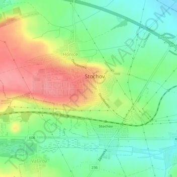
Name: Stochov topographic map, elevation, terrain.
Location: Stochov, okres Kladno, Central Bohemia, 273 03, Czechia (50.13741 13.94653 50.15502 13.97574)
Average elevation: 1,371 ft
Minimum elevation: 1,257 ft
Maximum elevation: 1,532 ft
Thank you for supporting this site ❤️
Make a donation
Make a donation
Gear up for your next adventure:
As an Amazon Associate, this site earns from qualifying purchases at no extra cost to you.