Geolocate

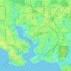
Pretty Bayou topographic map

Click on the map to display elevation.

About this map

Name: Pretty Bayou topographic map, elevation, terrain.

Location: Pretty Bayou, Panama City, Bay County, Florida, United States (30.19260 -85.67799 30.19478 -85.67590)

Average elevation: 33 ft

Minimum elevation: 10 ft

Maximum elevation: 49 ft

Bay County trails, hiking, mountain biking, running and outdoor activities

Other topographic maps

Click on a map to view its topography, its elevation and its terrain.
Saint Andrew

United States > Florida > Bay County > Panama City

Average elevation: 16 ft

Millville

United States > Florida > Bay County > Panama City

Average elevation: 30 ft

Millville

United States > Florida > Bay County > Panama City

Average elevation: 30 ft

Gear up for your next adventure:

🛡️Bear Spray Outdoor - Protection in bear country hikes
🔥Fast-Boil Camping Stoves - Efficient cooking systems for quick trail meals
🧭Outdoor Navigation Book - Learn advanced navigation skills
🧼Biodegradable Camping Soap - Eco‑friendly soap for outdoor hygiene
🪶Trail Camera - Capture wildlife on your hikes

As an Amazon Associate, this site earns from qualifying purchases at no extra cost to you.