Geolocate

Feijó topographic map

Click on the map to display elevation.

About this map
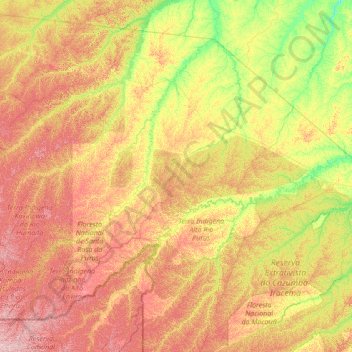
Name: Feijó topographic map, elevation, terrain.

Location: Feijó, Acre, North Region, Brazil (-10.00045 -72.18103 -7.79200 -69.44304)

Average elevation: 738 ft

Minimum elevation: 427 ft

Maximum elevation: 1,325 ft

Other topographic maps

Click on a map to view its topography, its elevation and its terrain.

Maloca

Brazil > Acre > Porto Walter

Average elevation: 646 ft

Bonfim

Brazil > Acre > Plácido de Castro

Average elevation: 614 ft

Gear up for your next adventure:

🔦Powerful Headlamps - Ultra-bright hands-free lighting for night navigation
🔌Solar Panel Charger - Charge gear sustainably outdoors
🔥Fast-Boil Camping Stoves - Efficient cooking systems for quick trail meals
⌚Solar GPS Watches - Advanced multisport watches with built-in topographic maps
🦟Ultrasonic Repellers - Create a bug-free zone at your camp or rest stop

As an Amazon Associate, this site earns from qualifying purchases at no extra cost to you.